
Editor in Chief

Murat Yakar was born in Mersin in 1968. He graduated from Selçuk University, Department of Geomatics Engineering in 1991, completed his PhD in 2002, and was promoted to full professor in 2017. An expert in photogrammetry and remote sensing, he has contributed to numerous international projects, including TIKA’s Mongolian Turkish Monuments Project, as well as nearly 50 national projects in Turkey. In 2017, he founded the Department of Geomatics Engineering at Mersin University, initiated several postgraduate programs, and played a leading role in launching major scientific congresses and international journals. He has authored 85 books, nearly 200 journal articles, and more than 200 conference papers, and continues to supervise graduate students in Turkey and abroad. Prof. Yakar currently serves at the Department of Geomatics Engineering, Faculty of Engineering, Mersin University.
Editorial board


Prof. Dr. Ahmed Serwa is currently working as a full Professor in Civil Engineering Department in Helwan University in Cairo, Egypt. His research interests include Land use/Land cover classification, monitoring and change detection, Image processing and Active (RADAR, SAR, Interferometric) remote sensing. Most of his works focus on using artificial intelligence (AI) in Photogrammetry, Remote Sensing and Geoinformatics. Prof. Dr. Serwa has some innovative ideas concerning the development of software, especially Geospatial Simulators to be used in the field of education, research and engineering . He is serving as an editorial member and reviewer of several international reputed journals. Prof. Dr. Ahmed Serwa is a member of many international affiliations. He has authored many research articles/books related to Geospatial Sciences.
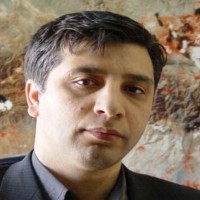
Dr. Khalil Valizadeh Kamran is currently working as a full Professor in the Department of Remote Sensing and GIS, University of Tabriz , Iran. His research interests includes Land use/Land cover classification, monitoring and change detection, Image processing, Thermal remote sensing, Remote sensing and GIS applied to climatology,Remote sensing and GIS application for Geohazard monitoring and risk assessment, SAR image processing, GIS based climatology. He is serving as an editorial member and reviewer of several international reputed journals. Prof. Dr. Khalil Valizadeh Kamran is the member of many international affiliations. He has successfully completed his Administrative responsibilities. He has authored of many research articles/books related to Land use.
I am guest researcher at Mersin University as a TUBITAK project

Amin Naboureh graduated with a Ph.D. in Physical Geography from the University of Chinese Academy of Sciences (UCAS) in 2022. He works as an Associate Research Professor at the Institute of Mountain Hazards and Environment, CAS. His research includes but is not limited to land cover/use mapping, crop type mapping, drought monitoring, water and agricultural management, and utilizing advanced ML algorithms for environmental management. He has been actively involved in multiple provincial, national, and international projects, serving as both a research team member and a principal investigator. Dr. Naboureh received excellent international student and graduate titles from UCAS in 2021 and 2022, respectively.
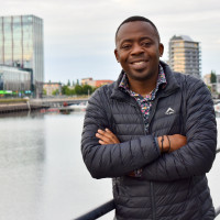
Dr. Franck Ghomsi is a distinguished physical oceanographer and geophysicist with broad expertise spanning both Earth's oceans and its deep interior. His research integrates gravimetry, geodynamics, and structural geology to understand features like continental rift systems and cratonic domains. Concurrently, he specializes in climate change, sea-level variability, and extreme climate events, with a firm commitment to protecting vulnerable coastal communities, particularly in Africa. His work is characterized by its approach of bridging rigorous science with practical adaptation solutions.
He holds dual PhDs in Oceanography from the University of Cape Town and Geophysics from the University of Yaoundé I. His extensive research has resulted in over 60 peer-reviewed publications in high-impact Q1 journals, including the Nature portfolio. A notable contribution is his high-resolution flooding model for the Gulf of Guinea, published in Nature Scientific Reports, which provides critical projections of sea-level rise impacts. Dr. Ghomsi actively contributes to the global scientific community as an Early Career Scientist Representative for the International Association of Geodesy (IAG) and its Inter-Commission Committee on Geodesy for Climate Research.

Dr. Olagoke Daramola received the bachelor’s and master’s degrees in surveying and geoinformatics from the University of Lagos, Lagos, Nigeria, in 2015 and 2020, respectively. He went on to obtain a FIG/IHO/ICA Category ‘A’ certificate in hydrographic science in 2023 and a Ph.D. in marine science (hydrography) in 2025, both from the University of Southern Mississippi, Hattiesburg, MS, USA. He has authored more than 25 peer-reviewed publications, 15 conference presentations and proceedings, and a book chapter. He has also served as a peer reviewer for several reputable journals, including Scientific Reports, International Journal of Remote Sensing (IJRS), The International Hydrographic Review (IHR), etc. He is currently a Research Associate with the University of Southern Mississippi. His research interests include underwater LiDAR signal processing and 3-D reconstruction, sonar processing, bathymetric data fusion, and spatial analytics.
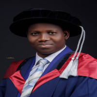
Dr. Ojima Isaac APEH is a Senior Lecturer (Assistant Professor) in the Department of Geoinformatics and Surveying at the University of Nigeria, Enugu Campus. He holds a Ph.D. in Geophysical Geodesy (Geodesy and Applied Geophysics) from The Hong Kong Polytechnic University, an M.Sc. in Geodesy and Geodynamics (Distinction), and a B.Sc. in Geoinformatics and Surveying (First Class Honours) from the University of Nigeria.
His research focuses on gravity field modelling, geodynamics, crustal deformation, and environmental geospatial analysis, with particular applications to rift zones and sedimentary Basins. Dr. Apeh has authored over 20 peer-reviewed publications and presented at major international conferences, including the EGU, AGU, and IUGG. He is a registered surveyor and an active member of several professional bodies, including the EGU, IAG, AGU, IUGG, and NIS.
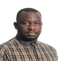
Dr Adeleke teaches surveying, geodesy and geoinformatics at the University of Pretoria, he is also a professional surveyor. His research focuses on feature extraction from imagery and applications of machine learning in renewable energy siting and resource estimation.

Dr Chukwuma John Okolie received the PhD degree in Geomatics from the Faculty of Engineering and the Built Environment, University of Cape Town, South Africa; and MSc and BSc degrees in Surveying and Geinformatics from the Faculty of Engineering, University of Lagos, Nigeria. From 2022 to 2023, he was a Visiting Researcher at the School of Engineering, Newcastle University, United Kingdom. He was a Lecturer in the Department of Surveying and Geo-informatics at the University of Lagos from 2017 to 2024. Currently, he is a Senior Research Officer at the African Centre for Cities located in the School of Architecture Planning and Geomatics, University of Cape Town. Dr Okolie has a proven track record of impactful teaching in higher education contexts. He has taught a variety of courses at undergraduate and postgraduate level including remote sensing, photogrammetry, geospatial information systems, digital mapping, land surveying and technical communication. His research interests include data fusion, urban data sensing, GIScience and remote sensing, Geospatial Artificial Intelligence, and environmental modelling. He has led several cross-disciplinary teams with researchers from around the world, and is highly published with about 100 articles in journals, books and conference proceedings. Dr Okolie has reviewed for reputable journals, and is passionate about mentoring future scholars through effective teaching and research guidance.
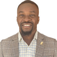
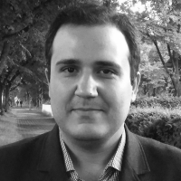
Hossein Bagheri, Ph.D. (Dr.-Ing.), is an Assistant Professor and Head of the Department of Geomatics Engineering at the University of Isfahan, Iran. He received his doctorate in Data Science (Signal Processing in Earth Observation) from the Technical University of Munich in cooperation with the German Aerospace Center (DLR).
His research focuses on geospatial data science, remote sensing, and artificial intelligence, with applications in environmental modeling, disaster risk reduction, and climate resilience. He has published extensively in international peer‑reviewed journals and conference proceedings across the fields of geoinformatics, environmental science, and Earth observation.
Dr. Bagheri has contributed to several international and national projects, including large‑scale initiatives on global urban mapping, multi‑sensor data fusion, and climate‑related risk assessment. His work has advanced methods for SAR‑optical stereogrammetry, air quality monitoring, renewable energy assessment, and urban climate modeling. He has also led applied projects in land use monitoring, flood risk analysis, and environmental change detection in collaboration with governmental and research organizations.
As an academic leader, he has served as Deputy for Research Affairs and now as Head of Department, while actively promoting open science, reproducible research, and interdisciplinary collaboration. He is committed to bridging methodological innovation with societal impact, ensuring that geospatial AI and Earth observation technologies contribute to sustainable development and climate adaptation worldwide.

Prof. Dr. Bakhtiar Feizizadeh has established himself as a distinguished scholar in geoinformation sciences, with significant achievements in both research and academic leadership. His work has been recognized with numerous prestigious international awards, including the Turkish Tubitak-2024 for joint research at Mersin University, the National Prize of Iran as top researcher in 2020 from the Iranian Ministry of Science, and the prestigious award of Alexander von Humboldt as an experienced researcher. Prof. Feizizadeh has been on the list of 2% of world scientists every year since 2019.He worked as an academic member and experienced researcher in several countries in very highly ranked universities such as the University of Salzburg, Austria; San Diego University, USA; Humboldt University of Berlin and the University of Munster, Germany; the University of Tabriz, Iran; and Mersin University, Türkiye. In recognition of his expertise, he has been invited to deliver lectures worldwide, including at the International Symposium on Digital Earth (ISDE), China, Humboldt University Berlin, University of Muenster, Germany, Université du Littoral Côte, France and Mersin University, Türkiye.