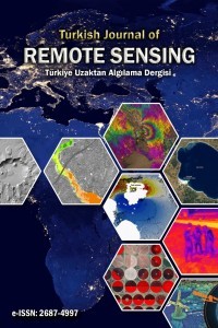
The Turkish Journal of Remote Sensing welcomes the submission of high-quality manuscripts that contribute substantially to the advancement of remote sensing and geospatial sciences. Manuscripts submitted to the journal must be original, scientifically sound, and within the journal’s scope.
The journal considers the following types of contributions:
- Original Research Articles presenting novel scientific findings and methodological advancements,
- Review Articles providing comprehensive and critical evaluations of current developments in the field.
The journal accepts English-language manuscripts only. Therefore, all submissions must be prepared and submitted in English.
Submission of Manuscripts;
Manuscripts must be submitted electronically through the journal’s online submission system available at:
https://dergipark.org.tr/en/journal/3138/submission/start
Authors are strongly encouraged to prepare their manuscripts using the journal’s official manuscript template to ensure compliance with formatting and submission requirements.
 Template File: 📝 TJRS_Article_Template_File_Rev_04.docx
Required Submission Files;
1-Plagiarism Report:
While your article is uploaded to the system, your plagarism report will be created via the "intihal.net" system. After your plagarism report created your article upload will be copmleted. Click for detailed information about "intihal.net". If any manuscript is 25% plagiarized the article will be rejected and the author will be notified.
2-Copyright Agreement Form :
The copyright of the article remains with the author(s). By filling and signing the Copyright Agreement Form presented on the journal website, the author(s) grant the journal the right of first publication of the article. The signed Copyright Agreement Form must be downloaded from here, signed, scanned, and uploaded to the system as a PDF. Publications of author(s) who do not submit this form cannot be published.
3-Ethics Committee Permission (If required)
An Ethics Committee Permission document must be submitted for the publication application of articles that require ethics committee approval.
Please inform the Turkish Journal of Remote Sensing whether your study requires Ethics Committee Approval by filling out the Ethics Committee Declaration section within the Copyright Form.
The Turkish Journal of Remote Sensing has been checking the ethical committee approval status of articles submitted since 2020. In this context, if your study falls into a category that requires ethical committee approval, you must upload the permission document along with your article files. Studies submitted to the journal that require ethical committee approval but lack the necessary permission documents will not be considered for evaluation.
Information regarding ethics committee approval is shared on the “Ethics Committee Approval” page.
Manuscript Preparation Guidelines
The manuscript template file is provided above for author use. Detailed formatting and preparation instructions are outlined below. Authors are expected to prepare their manuscripts in accordance with these requirements.
Abstract should be a single paragraph of about 300 words maximum. Also, it should be Cambria 9 font size, written justified and single line spaced. Keywords should consist of at least 3 and a maximum of 5 words. Except for proper names and abbreviations, all words should be written in lower case.
“Introduction” part should be followed by “Material & Method”, “Results”, “Discussion" and "Conclusion” parts.
The text should be written in a single column, using Cambria 10-point font. The indentation should be 4.6 cm. In addition, the first line of the paragraph should be written with 0.75 cm indented. Line spacing value should be used as 14 pt.
The article should be saved in MS Office Word as either .doc or docx. Text should be written as A4 size with 2 cm spacing at top, 1.6 cm bottom, 1.3 cm left and right side.
The main sections of the manuscript are "introduction", "material & method", "results", "discussion" and "conclusion" they should be written in 10 font size, justify, bold.
The second level headings should be written with left aligned, 10 font size, first character capital, bold.
Figures and tables should be referenced in the main text as Figure X, Table X, and so on. They should be left and right aligned and numbered. Figure and table captions should be written 9 font size, cambria, first letter of first word capital. It should not be written as bold or italic.
>>Statements and Declarations
>>The following sections should be included in the manuscript where applicable and prepared in accordance with the journal guidelines.
Acknowledgments: If there is an acknowledgment, please indicate it.
Author Contributions: Please make sure that the contribution of each author is clarified based on the CRediT (Contributor Roles Taxonomy) standards. This classification allows for a transparent and accurate description of each author's individual contribution to the work.
Please select the appropriate roles for each author from the list below:
Conceptualization
Methodology
Software
Validation
Formal analysis
Investigation
Resources
Data Curation
Writing—Original Draft
Writing—Review & Editing
Visualization
Supervision
Project Administration
Funding Acquisition
Below are examples of how to format this section:
Single Author
For manuscripts with a single author, please use the following statement:
"The author confirms sole responsibility for the following: study conception and design, data collection, analysis and interpretation of results, and manuscript preparation."
Two or More Authors
Please list authors' contributions using their names or initials as shown in the examples below: Author names must be written in the format of initial(s) followed by surname (e.g., O. Orhan, A. Yılmaz, M. Ö. Çelik).
Example Configuration :
O. Orhan: Conceptualization, Methodology,
A. Yılmaz: Writing-review and editing.
M. Ö. Çelik: Software, Data curation, Writing-original draft preparation.
A. T. Torun: Visualization, Writing-review and editing.
AI Contribution Statement: If generative AI or AI-assisted technologies were used during manuscript preparation, this should be clearly stated in this section. The purpose of use and the names of the tools utilized should be specified in detail. All AI-assisted outputs must be reviewed, controlled, and approved by the authors before submission.
Example: “Generative AI tools, including ChatGPT and DeepL Write, were used solely for grammar checking and academic language improvement. All scientific results and interpretations were reviewed, controlled, and approved by the authors.”
**Furthermore, authors must disclose any use of AI-based tools during manuscript preparation, in compliance with the journal’s AI Use Policy: https://dergipark.org.tr/en/pub/tuzal/page/19470
Funding: Please indicate whether the study is supported by an institution or not.
Example: “This study received no external funding” or “This study was funded by NAME OF FUNDER, grant number XXX”
Research and publication ethics statement: In the study, the author/s declare that there is no violation of research and publication ethics and that the study does not require ethics committee approval. (If exists will be notified)
Conflicts of Interest: Declare conflicts of interest or state “The authors declare no conflicts of interest.”. (If exists will be notified)
Data Availability: Authors should select the most appropriate Data Availability statement based on the nature of their study and data accessibility.
Example:” The data presented in this study are available on request from the corresponding author.”
“The data associated with this study are not publicly available due to privacy, institutional, or technical restrictions”
Abbreviations: (Optional)
References, tables, figures to be used must be prepared in accordance with APA 7. Articles that do not comply with the rules of writing and APA are eliminated in the first stage by the editor. You should review your references and check their compliance with APA 7. Some expamlpes of citations/references are given below;
References within the text;
(1) (Orhan, 2021). (Çoruhlu & Çelik, 2022). (Orhan et al., 2023; Zheng et al., 2025)
(2) Orhan (2021) stated…, As stated by Çelik et al. (2024)…
Articles
Surname, N., Surname, N., & Surname, N. (Year). Name of the article. Journal’s name, Vol(No), pp. XX-XX. (If there is doi)
Orhan, O. (2021). Land suitability determination for citrus cultivation using a GIS-based multi-criteria analysis in Mersin, Turkey. Computers and Electronics in Agriculture, 190, 106433. https://doi.org/10.1016/j.compag.2021.106433
Çoruhlu, Y. E., & Çelik, M. Ö. (2022). Protected area geographical management model from design to implementation for specially protected environment area. Land Use Policy, 122, 106357. https://doi.org/10.1016/j.landusepol.2022.106357
Books
Orhan, O., & Makineci, H. B. (2023). Agricultural land suitability analysis. Encyclopedia of Smart Agriculture Technologies. Springer.
e-Books
Brück, M. (2009). Women in early British and Irish astronomy: Stars and satellites. Springer Nature. https:/doi.org/10.1007/978-90-481-2473-2
Conference, symposium or paper presentation
Rutledge, L., LeMire, S., & Mowdood, A. (2015, March 25–28). Dare to perform: Using organizational competencies to manage job performance [Paper presentation]. Association of College & Research Libraries 2015 Annual Conference, Portland, OR, United States. http://www.ala.org/acrl/sites/ala.org.acrl/files/content/conferences/confsandpreconfs/2015/Rutledge_LeMire_Mowdood.pdf
Conference, symposium or paper proceedings published in a journal
Çoruhlu, Y. E., Çelik, M. Ö., Demir, O., & Yıldız, O. (2017). GIS applications in land management of protected areas. Proceedings Book of DOKAP Region International Tourism Symposium, Trabzon, Türkiye, 295-308.
Thesis
-Dissertation or Thesis from a Database
Orhan, O. (2018). Determining potential sinkhole areas using remote sensing and geographic information systems (Publication No. 565007) [Doctoral Thesis, Selçuk University]. YÖK National Thesis Center.
-Dissertation or Thesis Published Online (Not in a Database)
Lui, T. T. F. (2013). Experiences in the bubble: Assimilation and acculturative stress of Chinese heritage students in Silicon Valley [Master's thesis, Stanford University]. Graduate School of Education International Comparative Education Master's Monographs Digital Collection. https://searchworks.stanford.edu/view/10325276
Legislation
Official Gazette. (1983). Law 2942 Expropriation (Number: 18215).
Internet address
TUIK. (2024). Retrieved September 12, 2024, from https://www.tuik.gov.tr/
Click here for more reference citations.
Contact:
Assoc. Prof. Dr. Osman ORHAN
Telephone: +90-5059875275 (Editor)
Address: Mersin University, Faculty of Engineering, Department of Geomatics Engineering,
Çiftlikköy Campus, 33343, Yenişehir/Mersin, Turkey
e-mail: osmanorhan@mersin.edu.tr / tr.remotesensing@gmail.com / osmanorhan44@gmail.com