Journal Boards
Editor-in-Chief
Co-Editors

Ahmet Tarık TORUN currently works at the Academy of Land Registry and Cadastre, Ankara Hacı Bayram Veli University. Graduated from Aksaray Unversity Geomatics Engineering Msc and PhD. He does research in Remote Sensing, Geoinformatics (GIS), InSAR, Image Processing.


 Web
Web
Mustafa Ustuner received his PhD and MSc degrees in Geomatic Engineering from Yildiz Technical University and his BSc in Geodesy and Photogrammetry Engineering from Karadeniz Technical University, Türkiye. He was a visiting researcher in the Geo-Spatial Analytics Lab at the University of South Florida in the US and in the Department of Earth Observation, Institute of Geography at the Friedrich-Schiller-University of Jena in Germany.
Currently, He is working as an assistant professor for Samsun University, Türkiye. As an editorial task, I have been serving as an associate editor for the European Journal of Remote Sensing, Turkish Journal of Remote Sensing and Geoplanning: Journal of Geomatics and Planning. Also, He was one of the guest editors of the special issue entitled "Advances in Remote Sensing for Monitoring and Characterising Vegetation Responses to Changing and Extreme Climatic Conditions" in MDPI Remote Sensing.
His main research interests include Polarimetric Synthetic Aperture Radar (PolSAR) Remote Sensing, Applied Machine Learning and particularly Hyperspectral Data Analysis. Recently, he is working on dimensionality reduction and classification of hyperspectral images.
Editorial Board
Giuseppe Pulighe currently works at the Research Center for Agricultural Policies and Bioeconomy, Council for Agricultural Research and Economics (CREA). He is working in the field of Agronomy, Bioenergy, Land Use Change, Water Management, Remote Sensing and GIS. He has authored over 60 journal publications and conference contributions. Regularly serves as reviewer for international journals. I deliver professional training courses on SWAT+, with a focus on practical implementation and applied modelling in professional contexts.
Fabiana Calò received her Master’s degree in Environmental Engineering from Politecnico di Bari and a PhD in Analysis of Environmental Systems at University of Napoli Federico II. She has been Visiting Scientist at Canada Centre for Remote Sensing, Ottawa (2008) and Yildiz Technical University, Istanbul (2014-2015). Since 2010 she works at National Research Council (CNR) of Italy, Institute of Electromagnetic Sensing of Environment in Napoli, first as Post-Doc fellow and then as permanent Researcher. Her research interests mainly focus on the study of natural and man-made hazards, and on the natural resources protection by integrating ground-based and Earth Observation data and information.
Omid Ghorbanzadeh holds a BSc in Mathematics, MSc in RS & GIS, and a Ph.D. in Applied Geoinformatics from the University of Salzburg, Austria, in 2021. Currently, he's a Senior Researcher at BOKU in Vienna. Omid's research focuses on developing Human-in-the-Loop (HITL) and Geo-explainable (Geo-X) AI for RS applications. He's published in journals like Mathematics and IEEE TGRS and received multiple best paper awards. He is also among the 'World's Top 2% Scientists' in Stanford University's 2023, and 2024 ranking.
I received my Ph.D. in engineering with a certificate of commendation from the Graduate School of Natural Science and Technology, Kanazawa University in Japan in 2015. Subsequently, I was awarded a JSPS fellowship, a prestigious award in Japan with an acceptance rate below 10%, and I worked as a research fellow at the Tokyo Institute of Technology for a duration of two years, spanning from 2016 to 2018. In 2019, I served as a postdoctoral researcher at RIKEN, Geoinformatics Unit. From 2019 to 2024, I was an assistant professor in Department of Remote Sensing and GIS in the University of Tabriz. I also visited Gebze Technical University (GTU) and Istanbul Technical University (ITU) as a TUBITAK-supported visitor in 2022 and 2024, respectively. Since 2024, I am an associate professor in Department of Remote Sensing and GIS in the University of Tabriz. I am also an IEEE GRSS (Geoscience and Remote Sensing Society) Senior Member from 2025.

After graduating from Ankara Anatolian High School, I completed my undergraduate education in Landscape Architecture, my master's degrees in Landscape Planning and Environmental Management, and my PhD in Environmental Economics. I worked at Ankara University, University of Massachusetts (World Bank Scholarship), TUBITAK, American Geomatics Group, Geotech Company and finally at Anadolu University, Department of Architecture and Institute of Earth and Space Sciences. In addition to the Directorate of the Institute of Earth and Space Sciences, I served as the Head of the Departments of Architecture, Basic Design Education and Fashion Design, and I was the Head of Remote Sensing and GIS. I served as Vice Rector and Dean of the Faculty of Architecture and Design at Eskişehir Technical University. I am currently serving as the Chairman of the Board of Directors of the Design and Planning Accreditation Association.
I have worked in many national-international projects, contributed to the establishment of various academic programmes and training programmes, and collaborated with many national and international organisations for this purpose, in order to use and disseminate technologies such as remote sensing, terrestrial photogrammetry, aerial photogrammetry, etc., especially geographic information systems, in order to investigate human settlements that are not threatening the environment and where the environment is not threatened by disasters.
In summary, I am a world and homeland lover who is trying to contribute to the upbringing of generations who respect the earth - the world - and to the projects that will illuminate the path of these generations. I have lit many lights so far, and I am trying to do everything I can to see them illuminate our country first and then the world. If you think you can contribute to the illumination of our world by these lights, you can contact me.

His scientific work focuses on hybrid artificial intelligence frameworks that integrate data-driven learning with formal spatial, numerical, and geometric models. These methods are applied to remote sensing, LiDAR and photogrammetric data processing, spatial decision-support systems, and database-centered analytical architectures.
Artur Janowski has authored and co-authored more than 120 peer-reviewed articles published in international journals and has participated in numerous national and international research and implementation projects funded by public agencies and international organizations, including the National Science Centre and the European Space Agency. His recent research addresses intelligent urban infrastructure systems, automated real estate analysis, augmented and mixed reality applications, and AI-assisted spatial valuation methodologies.
He serves as a reviewer and expert for international scientific journals and research programs. His current research interests include explainable and hybrid machine learning, large-scale geospatial data fusion, and the deployment of reliable AI systems in socio-economic and environmental applications.
Dr. Khalil Valizadeh Kamran is currently working as a full Professor in the Department of Remote Sensing and GIS, University of Tabriz , Iran. His research interests includes Land use/Land cover classification, monitoring and change detection, Image processing, Thermal remote sensing, Remote sensing and GIS applied to climatology,Remote sensing and GIS application for Geohazard monitoring and risk assessment, SAR image processing, GIS based climatology. He is serving as an editorial member and reviewer of several international reputed journals. Prof. Dr. Khalil Valizadeh Kamran is the member of many international affiliations. He has successfully completed his Administrative responsibilities. He has authored of many research articles/books related to Land use.
I am guest researcher at Mersin University as a TUBITAK project

João Pedro Carvalho received the M.Sc. (Hons.) and Ph.D. degrees in electrical and computer engineering from FCT NOVA, Portugal, in 2017 and 2021, respectively. He is currently Assistant Professor at the Dept. of Informatics of the Faculty of Sciences of the University of Lisbon. Since 2025, he has been an Integrated Member of LASIGE and collaborator of the Center of Technology and Systems (CTS), UNINOVA, and COPELABS. He won the highly competitive Scientific Employment Stimulus (CEEC institutional) FCT grant in 2021. He has published more than 50 papers in international journals and international conferences in the fields of remote sensing, pattern recognition, machine learning, sensor networks, and signal processing, with significant recognition and impact in the research community.

Dr. Aşır Yüksel Kaya lisans derecesini Afyon Kocatepe Üniversitesi Coğrafya bölümünden, yüksek lisans ve doktora derecelerini ise Fırat Üniversitesi Coğrafya bölümünden almıştır. Doktora eğitimi sırasında TÜBİTAK bursu ile Birmingham City Üniversitesinde (İngiltere) misafir araştırmacı olarak bulunmuştur. Doktora sonrasında ise Griffith University Cities Research Institute Post Doktora araştırmalarında bulunmuştır. 2020 yılından itibaren Fırat Üniversitesi Coğrafya bölümünde Dr. Öğretim Üyesi olarak çalışmaktadır. Dr. Kaya’nın araştırmaları, Kent ve kentleşme analizleri, CBS ve uzaktan algılama algoritmaları konuları üzerine yoğunlaşmıştır ve bu konularda ulusal/uluslararası bilimsel dergilerde makaleleri bulunmaktadır. Dr. Kaya Griffith University Cities Research Institute Adjunct Members olarak çalışmalarına devam etmektedir.


Advisory Board

Caner Ozdemir received the B.S.E.E. degree in 1992 from the Middle East Technical University, Ankara, Turkey, and the M.S.E. and Ph. D. degrees in Electrical & Computer Engineering from the University of Texas at Austin in 1995 and 1998, respectively.
From 1992 to 1993, he worked as a project engineer at the Electronic Warfare Programs Directorate of ASELSAN Electronic Industries Inc., Ankara, Turkey. From 1998 to 2000, he worked as a research scientist at Electronic & Avionics Systems (ASTG) group of AlliedSignal Inc., Columbia, Maryland. He joined the faculty of Mersin University in 2000 and is currently a professor in the department of Electrical-Electronics Engineering, Mersin, Turkey. He has been serving as a consultant to the Marmara Research Center of the Scientific and Research Council (TUBITAK) of Turkey and many defense industry firms. Dr. Ozdemir’s research interests are radar cross section, radar image/signal processing, inverse synthetic aperture radar (ISAR), radar cross section, ground penetrating radar, through-the-wall imaging radar and antenna design. He has published more than 180 journal articles and conference/symposium papers on these subjects.
Dr. Ozdemir is a recipient of URSI EMT-S Young Scientist Award in the 2004 International Symposium on Electromagnetic Theory in Pisa, Italy and also recipient of a JARS best paper award for photo-optical instrumentation published in the Journal of Applied Remote Sensing in 2016. He is the author of the book titled “Inverse Synthetic Aperture Radar Imaging with Matlab Algorithms”.
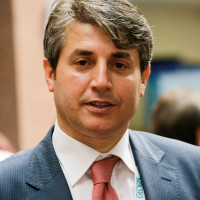
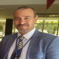
Active research areas include: assessment of the vulnerability of groundwater to pollution and groundwater potential, site selection, determination the morphometric characteristics of various geographic features, determining temporal changes in land use, surface temperature, and vegetation cover using Geographic Information System (GIS) and Remote Sensing (RS) techniques.
Language Editor
Layout Editor
