Baş Editör








Editörler

Dr. Fatih OCAK, Eskiizmir Naci Şensoy Lisesi’ni bitirdikten sonra Afyon Kocatepe Üniversitesi Fen Edebiyat Fakültesi Coğrafya Bölümü’nden 2009 yılında birincilikle mezun oldu. 2010-2011 yılları arasında Ege Üniversitesi Eğitim Fakültesi’nde pedagojik formasyon, Ondokuz Mayıs Üniversitesi Sosyal Bilimler Enstitüsü Coğrafya Anabilim Dalında Ünye Şehir Sellerinin Zarar Görebilirlik Yöntemi ile İncelenmesi başlıklı tez ile 2018 yılında yüksek lisansını, Ondokuz Mayıs Üniversitesi Lisansüstü Eğitim Enstitüsü Coğrafya Anabilim Dalında Ladik Gölü Havzası'nda (Samsun) Akıllı Doğal Afet Yönetimi başlıklı tez ile 2023 yılında doktorasını tamamladı. 2009-2017 yılları arasında özel sektörde Coğrafi Bilgi Sistemleri alanında önemli görevler üstlenen Ocak 2017-2018 yılları arasında Ondokuz Mayıs Üniversitesi, 2018-2025 yılları arasında Samsun Üniversitesi Kavak MYO’da öğretim görevlisi olarak çalışmıştır. 2025 yılının mayıs ayından itibaren de Marmara Üniversitesi İnsan ve Toplum Bilimleri Fakültesi Coğrafya Bölümü'nde öğretim üyesi olarak çalışmaktadır. Temel ilgi alanları; Coğrafi Bilgi Sistemleri (CBS), web CBS, uzaktan algılama ve doğal afetler olan Ocak evli ve bir çocuk babasıdır.

1991 yılında Samsun’da doğdu. İlk, orta ve lise eğitimini Samsun’da tamamladı. 2014 yılında Balıkesir Üniversitesi Fen Edebiyat Fakültesi Coğrafya Bölümü’nden mezun olduktan sonra yine aynı bölümden 2016 yılında yüksek lisans derecesini aldı. 2022 yılında Ondokuz Mayıs Üniversitesi Coğrafya Anabilim Dalı’ndan doktora derecesini aldı. 2017-2022 yılları arasında Araştırma Görevlisi olarak çalıştığı Tokat Gaziosmanpaşa Üniversitesi Coğrafya Bölümü’nde 2022 yılında bu yana Doktor Öğretim Üyesi olarak görev yapmaktadır.
Alan Editörleri
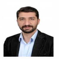
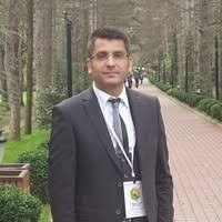
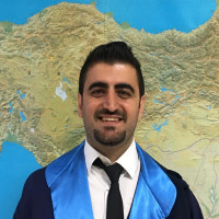
14/08/1989 tarihinde Hatay’ın Merkez İlçesi Antakya’da doğdu. İlk ve Ortaokulu Cemil Şükrü Çolakoğlu İlköğretim Okulu’nda okudu. 2003 yılında başladığı liseyi, Necmi Asfuroğlu Lisesi’nde okudu ve 2006 yılında mezun oldu. 2007 yılında Kahramanmaraş Sütçü İmam Üniversitesi Fen Edebiyat Fakültesi Coğrafya Bölümü’nü kazandı.
2011 yılında bu okuldan mezun olduktan sonra, 2012 yılında aynı okulda yüksek lisans eğitimine başladı. 2013 yılında, Öğretim Üyesi Yetiştirme Programı (ÖYP) kapsamında Hatay Mustafa Kemal Üniversitesi Fen Edebiyat Fakültesi Coğrafya Bölümü’ne Araştırma Görevlisi olarak atandı. Aynı yıl görevlendirmeyle (YÖK 39. Maddesi) ODTÜ’de 6 aylık yabancı dil eğitimi aldı. 2015 yılında “Antakya (Hatay) Şehir Coğrafyası” isimli yüksek lisans tezini tamamladı. 2015 yılında YÖK yönetmeliğinin 35. Maddesine bağlı olarak doktora eğitimini gerçekleştirmek üzere Marmara Üniversitesi Sosyal Bilimler Enstitüsü’ne görevlendirildi. 2018 yılında kadrosunun bulunduğu Hatay Mustafa Kemal Üniversitesi’ne döndü. Ocak-2020’de “Karşılaştırmalı Bir Şehir Coğrafyası: Alanya ve Manavgat Örneği” isimli doktora tezini tamamlayarak doktor ünvanını aldı. Hatay Mustafa Kemal Üniversitesi Coğrafya Bölümü’nde Dr. Öğr. Üyesi olarak akademik çalışmalarını sürdürmektedir. Evli ve iki çocuk babasıdır

Yayın Editörü
İstatistik Editörü
Yazım Editörü

Mizanpaj Editörü


Yabancı Dil Editörü
Danışma Kurulu (Üyeler)

Dr. Ateşoğlu's research interests are Remote Sensing-Applications in Forestry, Geographic Information Systems, and Land use/cover classification & Change detection. He has published several research articles and also review articles, which appeared in National, International journals and proceedings.
M. Sc. Thesis: “Detection of Land Use Changes in Bartin Province Using Remotely Sensed Images” (2003) Zonguldak Karaelmas University, Turkey
Ph.D Thesis: “Studying the Relations between Different Satellite Image Data and Stand Parameters (Bartın-Mugada Case Study)” (2009), Bartin University, Turkey
Selected Papers
Varol, T., Atesoglu, A., Ozel, H. B., & Cetin, M. (2023). Copula-based multivariate standardized drought index (MSDI) and length, severity, and frequency of hydrological drought in the Upper Sakarya Basin, Turkey. Natural Hazards, 116(3), 3669-3683.
Akturk, E., Altunel, A. O., Atesoglu, A., Seki, M., & Erpay, S. (2023). How good is TanDEM-X 50 m forest/non-forest map? Product validation using temporally corrected geo-browser supplied imagery through Collect Earth. International Journal of Geographical Information Science, 37(5), 1041-1068.
Colkesen, I., Kavzoglu, T., Atesoglu, A., Tonbul, H., & Ozturk, M. Y. (2023). Multi-seasonal evaluation of hybrid poplar (P. Deltoides) plantations using Worldview-3 imagery and state-of-the-art ensemble learning algorithms. Advances in Space Research, 71(7), 3022-3044.
Ozdarici-Ok, A., Ok, A. O., Zeybek, M., & Atesoglu, A. (2022). Automated extraction and validation of Stone Pine (Pinus pinea L.) trees from UAV-based digital surface models. Geo-spatial Information Science, 1-21.
Atesoglu, A, Ozel, H. B., Ucar, Z (2022) An Assessment of Land Use Cover Change and Vegetation Trend Analysis Using Web-Based GIS in Selected Regions (Syria And Iraq) of Euphrates-Tigris River Basin, Fresenius Environmental Bulletin, 2022, 1018-4619, 31, 9, 9772-9783.
Atesoglu, A. (2020) Assessment and Monıtorıng of Land-Use and Land-Cover Conversıon (2000-2017) In Turkey Usıng Collect Earth Methodology, Fresenius Environmental Bulletin, 2020, 1018-4619, 29, 7, 5055-5067.
Bastin J. F., Berrahmouni N., Grainger A, Maniatis D, Mollicone D, Moore R, Patriarca C, Picard N, Sparrow B, Abraham E. M, Aloui K, Ateşoğlu A., Attore F., Başsüllü Ç., Bey A, Garzuglia M, Garcia M. L. G, Groot N, Guerin G, Leastadius L, Lowe A., Momane B., Marchi G., Patterson P, Rezende M, Ricci S, Salcedo I, Diaz P., Alfonso S, Stolle F, Surappaeva V., Castrı R. 2017. The extent of forest in dryland biomes, Science, 356/6338, pp 635-638. 10.1126/science.aam6527
Sefercik, U. G., Ateşoğlu, A. 2017. Three-dimensional forest stand height map production utilizing airborne laser scanning dense point clouds and precise quality evaluation, iForest - Biogeosciences and Forestry, 10/2, pp. 491-497. 10.3832/ifor2039-010
Ateşoğlu, A., Arslan, A., Yılmaz M., Arıkan, T. B., Yıldız S. 2017 Monitoring of Dryland in Turkey Using Collect Earth, Afyon Kocatepe University Journal of Science and Engineering .17 (2017) Special Issue (252-261)
Atesoglu, A., 2015. Remote Sensing and GIS Applications for Suitable Afforestation Area Selection in Turkey. Journal of the Faculty of Forestry Istanbul University (JFFIU), 65(1), 53-59., DOI: 10.17099/jffiu.00032.
Atesoglu, A., 2015. Multitemporal Analysis (1975-2011) of Vegetation Changes in Urban Land Uses: Case of The City of Bartın, Turkey. Journal of Environmental Biology, 36(2), 473-481.
Atesoglu, A., 2014. Forest Fire Hazard Identifying Mapping Using Satellite Imagery-Geographic Information System and Analytic hierarchy Process: Bartın, Turkey. Journal of Environmental Protection and Ecology (JEPE), 15(2), 715-725.
Atesoglu, A., Tunay, M. 2013. Relatıonshıps Between Eastern Beech Forests Stand Parameters And Landsat Etm Spectral Responses In Turkey. Journal Of The Bartın Faculty Of Forestry, 15(1-2), 76-87.,
Skills & Abilities
Remote sensing-applications in forestry, agricultural, society and environmental (ENVI; PCI; Collect Earth, GEE)
Geographic information systems applications (ESRI; NetCad; QGIS)
Land use/cover classification & Change detection
Employment History&Experience
| Employer | Bartın University | |
| Job Title | Academic Staff | |
| Professional Area | Forestry; Landscape | |
| Start Date | Oct/2000 | |
| End Date | Current Job | |
| Country | Turkey | |
| City | Bartın | |
| Employer | Republic of Turkey Ministry of forestry and Water Affairs |
| Job Title | Land degradation neutrality (LDN) Monitoring Expert |
| Professional Area | Land and Water Management; Land cover/using classification |
| Start Date | Jul/2015 |
| End Date | May/2016 |
| Country | Turkey |
| City | Ankara |
| Description of the Job | Global forest survey; Global dryland assessment for Middle east region; Global forest survey project dryland assessment for Middle east region (application, evaluation of results and report preparation (for FAO forestry department) |
| Employer | Republic of Turkey Ministry of forestry and Water Affairs |
| Job Title | LDN Monitoring Expert |
| Professional Area | Land and Water Management; Land cover/using classification |
| Start Date | Jan/2016 |
| End Date | Nov/2017 |
| Country | Turkey |
| City | Ankara. Konya |
| Description of the Job | Land cover/use monitoring using Collect Earth in Turkey (within Global dryland assessment) Scientific report for Republic of Turkey Ministry of forestry and Water Affairs; General Directorate of Combating Desertification and Erosion; Land degradation neutrality; Assessment of the Konya basin within the scope global forest survey (Bartin University; scientific research project). Assessment of the Yukari Sakarya basin within the scope global forest survey (Scientific report for Republic of Turkey Ministry of forestry and Water Affairs; General Directorate of Combating Desertification and Erosion). Assessment of the Sorgun basin within the scope global forest survey (It was presented The twelfth session of the Conference of the Parties (COP 12) to the United Nations Convention to Combat Desertification (UNCCD)); Monitoring of irrigable agricultural land in Euphrates-Tigris river basin in middle east (Scientific report for Republic of Turkey Ministry of forestry and Water Affairs; General Directorate of Combating Desertification and Erosion) It is presented V. Internatıonal Workshop on Sand and Dust Storms ‘dust sources and their impacts in the Middle East): International Training on Combating Desertification meeting (Introduction of Collect Earth methodology within Land degradation neutrality) |
| Employer | Bartın University & Republic of Turkey Ministry of forestry and Water Affairs |
| Job Title | LDN Monitoring Expert |
| Professional Area | Land and Water Management; Land cover/using classification |
| Start Date | Jul/2015 |
| End Date | Nov/2017 |
| Country | Turkey |
| City | Ankara |
| Description of the Job | Land degradation neutrality; Assessment of the Konya basin within the scope global forest survey (Bartin University; scientific research project). Assessment of the Yukari Sakarya basin within the scope global forest survey (Scientific report for Republic of Turkey Ministry of forestry and Water Affairs; General Directorate of Combating Desertification and Erosion). Assessment of the Sorgun basin within the scope global forest survey (It was presented The twelfth session of the Conference of the Parties (COP 12) to the United Nations Convention to Combat Desertification (UNCCD)) |
| Employer | Food and Agriculture Organization of the United Nations |
| Job Title | LULC Expert |
| Professional Area | Earth Observation, Collect Earth |
| Start Date | Oct/2019 |
| End Date | Dec/2019 |
| Country | Turkey |
| City | Ankara |
| Description of the Job | Africa DEAL Mapathon carried out with the support of the BRIDGES project on the Great Green Wall in order to collect data for countries in the GGW region Collect Earth; Ankara, Turkey, International Agriculture Training Center. |
| Employer | TÜBİTAK; The Scientific and Technological Research Council of Türkiye |
| Job Title | LULC Expert |
| Professional Area | Earth Observation |
| Start Date | Feb/2021 |
| End Date | Feb/2023 |
| Country | Turkey |
| City | Bartın |
| Description of the Job | The Monitoring of Ecological Conditions and Land use/Land cover of Turkey’s Mountain ecosystem, and Development of a Remote Sensing Based Algorithm for Climate Change Adaptation Capacities; The aims and objectives of the project are to determine the land cover/use classes and changes related to mountainous areas on a national scale, to identify land degradation and recovery areas, and to analyze the factors (Normalized difference vegetation index (NDVI), Net primary production (NPP), Temperature, soil moisture, precipitation, evapotranspiration, etc.) affecting mountain ecosystems.. |
| Employer | Food and Agriculture Organization of the United Nations |
| Job Title | Land degradation neutrality (LDN) Expert |
| Professional Area | Earth Observation, Collect Earth |
| Start Date | Nov/2022 |
| End Date | Continues |
| Country | Turkey |
| City | Ankara, Antalya |
| Description of the Job | Forest Restoration Improvement for ENvironmental Development and Sustainability in Central Asia (FRIENDS); GCP/SEC/021/TUR. |
Education
| Institution | Karadeniz Technical University |
| Academic Qualification | Bachelor's Degree (or equivalent) |
| Institution Location | Trabzon |
| Exact title of Qualification obtained | Bachelor |
| Main Subject | Forestry |
| Status | Completed |
| Start Date | Sep/1995 |
| Graduation Date | Jun/1999 |
| Institution | Zonguldak Karaelmas University |
| Academic Qualification | Master's Degree |
| Institution Location | Bartın |
| Exact title of Qualification obtained | M. Sc. |
| Main Subject | Forestry |
| Status | Completed |
| Start Date | Jan/2000 |
| Graduation Date | Jan/2003 |
| Title of the thesis / other information | M. Sc. Thesis Detection of Land Use Changes in Bartın Province Using Remotely Sensed Images |
| Institution | Bartin University |
| Academic Qualification | Doctorate |
| Institution Location | Bartın |
| Exact title of Qualification obtained | Ph. D. |
| Main Subject | Forestry |
| Status | Completed |
| Start Date | Jun/2003 |
| Graduation Date | Jan/2009 |
| Title of the thesis / other information | Ph. D. Thesis: Studying the Relations Between Different Satellite Image Data and Stand Parameters (Bartın-Mugada Case Study) |
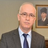
Türkiye Coğrafyası Anabilim Dalı öğretim üyesi olan Şahin; Türkiye nüfusu, nüfus politikaları, göç ve yer adları konularında akademik çalışmalar yaptı. Bu alanlarda lisans ve lisansüstü dersler yanında çok sayıda konferans verdi.
İstanbul'un nüfus özellikleri konusunda çalışmaları bulunan Şahin, İstanbul’un aldığı göçler konusunda çeşitli çalışmalar yaptı. Bu kapsamda; Erzurum, Tokat, Giresun ve Denizli’den İstanbul’a olan göçler konusunda yayınları oldu. Ayrıca coğrafya ve mekan ilişkisi kapsamında, Cumhuriyet Dönemi İstanbul’un mekânsal gelişimi konusunda çalışmalar yaptı.
Milli Eğitim Bakanlığı Coğrafya 10. Sınıf (2017-2018), Coğrafya 12. Sınıf (2017- 2022) ve Coğrafya 11. Sınıf (2024-2025) lise coğrafya ders kitaplarının editörlüğünü yaptı.
Marmara Üniversitesi'ndeki görevi yanında, 2011 ve 2012 yıllarında KKTC Yakın Doğu Üniversitesi'nde çeşitli dersler verdi.
Şahin, 2018-2021 yılları arasında Atatürk Kültür Dil Tarih Yüksek Kurumu Atatürk Kültür Merkezi Başkanlığı Bilim Kurulu asli üyelisi olarak görev yaptı.
Akademik dergi ve sempozyumlarda editörlük, bilim, yayın ve düzenleme kurulu üyeliği yaptı. Akademik faaliyetler yanında enstitü müdürlüğü, dekan yardımcılığı gibi idari görevlerde bulundu.
Şahin, halen Milli Savunma Üniversitesi Deniz Harp Okulu Dekanı olarak görev yapmaktadır.
Prof. Dr. Cevdet YILMAZ
Ondokuz Mayıs Üniversitesi / Eğitim Fakültesi / Türkçe ve Sosyal Bilimler Eğitimi Bölümü / Coğrafya Eğitimi Anabilim Dalı / Samsun
YÖKSİS Araştırmacı ID : 3676
ORCİD: https://orcid.org/0000-0003-0430-619X
Kısa Özgeçmiş
Prof. Dr. Cevdet YILMAZ 16.11.1962’de Sinop’un Türkeli ilçesinde doğdu. İlk ve orta öğrenimini bu ilçede, lise ve üniversite eğitimini İstanbul’da tamamladı. İstanbul Üniversitesi Edebiyat Fakültesi Coğrafya Bölümü’nden 1983’de mezun olan Yılmaz, yüksek lisans ve doktora eğitimini de İstanbul Üniversitesi Sosyal Bilimler Enstitüsü’nde yaptı. 1986-88 yılları arasında Sivas’ta iki yıl öğretmenlikten sonra 1988 yılında 19 Mayıs Üniversitesi Eğitim Fakültesi’nde akademik hayata başladı. 2009’da profesör olan Yılmaz 2010-2014 yılları arasında OMÜ Eğitim Fakültesi dekanlık görevini yürüttü. Evli ve iki çocuk babası olan Prof. Dr. Cevdet Yılmaz halen Ondokuz Mayıs Üniversitesi Eğitim Fakültesi, Türkçe ve Sosyal Bilimler Eğitimi Bölümü, Coğrafya Eğitimi Anabilim Dalı Başkanı ve Öğretim Üyesi olarak görevini sürdürmektedir. Bir kısmı telif, bir kısmı editör olarak emek verdiği 20 civarında kitabı, 100 civarında da yayınlanmış bildiri ve makalesi bulunan Yılmaz’ın başlıca çalışma alanı Beşeri ve İktisadi Coğrafya bilim dalı olup, bu çerçevede nüfus ve göçler, yerleşme ve meskenler, ekonomik faaliyetler, turizm, kırsal kalkınma, doğal çevre sorunları, coğrafya eğitimi gibi konulardır.
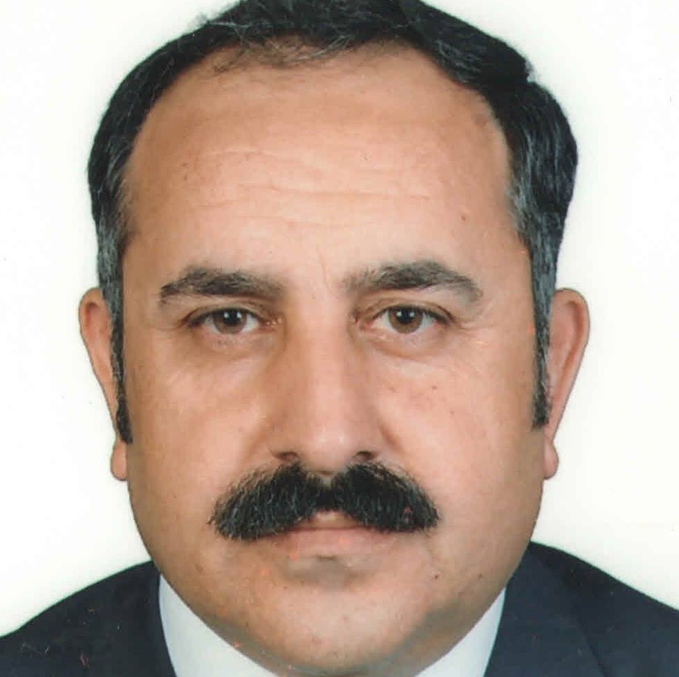
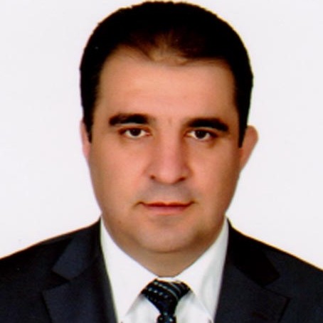
Prof. Dr. Aleksandar Valjarević is a Full Professor at the Faculty of Geography, University of Belgrade, Serbia. He obtained his Master's degree from the Faculty of Mathematics, University of Belgrade, and earned his Ph.D. in Geosciences from the University of Niš. Throughout his academic career, he has held teaching and research positions at several higher education institutions, including the Faculty of Natural Sciences and Mathematics, University of Priština, before joining the University of Belgrade.
Professor Valjarević's research focuses on Geographic Information Systems (GIS), remote sensing, climatology, environmental sciences, hydrology, natural hazards, land-use and land-cover change, spatial modeling, sustainable development, tourism geography, and climate change adaptation. His work integrates advanced geospatial technologies with statistical and numerical methods to address complex environmental and socio-economic challenges.
He has authored more than 250 scientific publications, including over 90 papers indexed in the Science Citation Index (SCI). His research has appeared in numerous high-impact international journals and has contributed significantly to the fields of geospatial analysis, environmental monitoring, climate extremes, ecosystem assessment, and disaster risk reduction. He serves as a reviewer and editorial board member for many international journals published by leading academic publishers.
Professor Valjarević has participated in numerous national and international research projects related to climate change, environmental sustainability, geospatial technologies, renewable energy, water resources, tourism development, and natural hazard assessment. His current research emphasizes the application of GIS, remote sensing, machine learning, and spatial analysis for improving environmental management and supporting sustainable development.
In addition to his scientific achievements, Professor Valjarević is actively engaged in international academic cooperation through conference organization, keynote lectures, editorial activities, and collaborative research with institutions across Europe, Asia, Africa, and the Middle East. His work continues to advance interdisciplinary approaches to understanding environmental processes and promoting evidence-based decision-making in geography and environmental sciences.

Doğal Afetler ve Afet Yönetimi, İklim Değişmeleri ve Çevresel Etkileri, Doğal Ortam - İnsan İlişkileri, Doğal çevre planlaması, Antropojenik Jeomorfoloji,

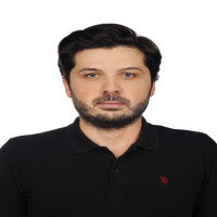
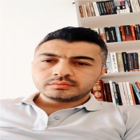
Interested in: Geopolitics-Globalization-Tourism.
Journal of Anatolian Geography aksi belirtilmedikçe, Creative Commons Attribution-ShareAlike 4.0 Uluslararası Lisansı (CC BY-SA 4.0) kapsamında lisanslanmıştır.